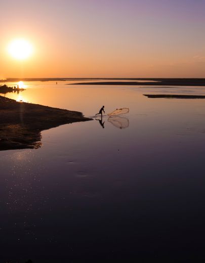
Every monsoon, the first signs of flooding in Assam rarely arrive with dramatic headlines. They begin in courtyards like the one in Morigaon, where a family quietly lifts sacks of rice onto a bamboo platform, seals land deeds and school certificates inside plastic bags, and unties cattle before moving them to higher ground. Next door, a fisherman secures his boat, knowing it may soon become the only way to reach the market—or the school. Someone calls relatives upstream with the question that echoes across the Brahmaputra Valley every year: Has the river started rising? By the time floodwaters enter homes, the crisis has already been unfolding for days.
For many outside the Northeast, Assam’s floods are reduced to images of submerged villages, rescue boats and relief camps. Yet those scenes capture only the aftermath. Flooding has always been part of Assam’s landscape. For centuries, the Brahmaputra and Barak river systems have shaped the state’s ecology, agriculture and settlements, depositing fertile soils even as they eroded riverbanks and redrew the land itself. The rivers rising with the monsoon is not the anomaly—it is the rhythm around which Assam has evolved. The real question, therefore, is not why the rivers flood, but why seasonal floods repeatedly become humanitarian disasters.
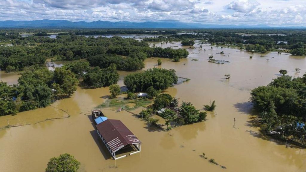
The answer lies not in the river alone, but in the choices made around it. As wetlands have disappeared, floodplains urbanised and settlements expanded behind ageing embankments, natural floods have become increasingly destructive. Climate change is intensifying rainfall, but it is colliding with decades of ecological degradation and planning decisions that have amplified the risks. The flood is natural; the disaster is increasingly human-made.
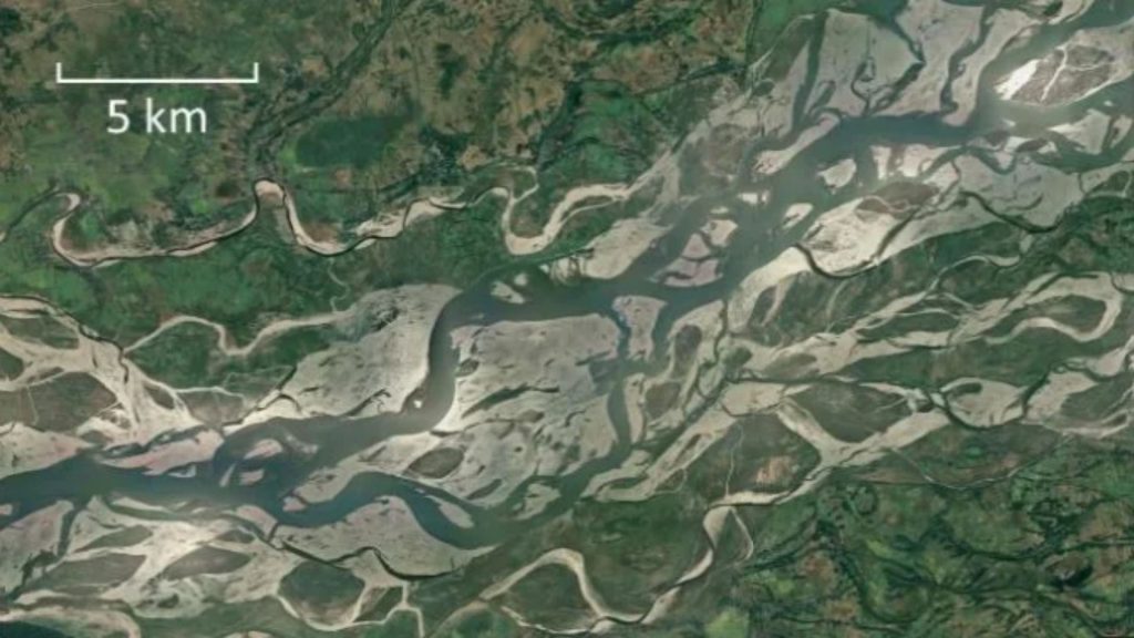
Assam is shaped by two great river valleys—the Brahmaputra Valley in the north and the Barak Valley in the south. Together, they define not only the state’s geography but also its ecology, economy and everyday life. Yet to understand why Assam floods, one must first understand the rivers themselves.
Originating on the Tibetan Plateau, the Brahmaputra enters India through Arunachal Pradesh as the Siang before gathering tributaries from the Eastern Himalayas and Bhutan. Its vast catchment collects rainfall from across the region, meaning communities in Assam can experience floods even when local rainfall is relatively moderate. As the river descends from the steep Himalayas into Assam’s flatter plains, it slows dramatically, depositing nearly 400 million tonnes of sediment every year. Rather than flowing through a single stable channel, the Brahmaputra constantly divides, merges and shifts across multiple braided channels, reshaping islands, sandbars and riverbanks with every monsoon.
Southern Assam follows a different geography but a similar rhythm.
The Barak River and its tributaries drain Cachar, Hailakandi and Sribhumi before flowing into Bangladesh, where intense rainfall, overflowing rivers and drainage constraints also produce recurring floods. Across both valleys, flooding is not an exceptional event but an intrinsic feature of the landscape. For centuries, fertile alluvial soils have supported agriculture, trade and settlements along these rivers, bringing both prosperity and seasonal inundation. In Assam, floods are not simply the result of heavy rain—they are the natural expression of water, sediment, topography and one of the world’s most dynamic river systems.
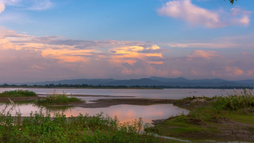
Public conversations often refer to “the Assam floods” as though they describe a single event. In practice, multiple kinds of flooding occur across the state, each with different causes and consequences. Recognising these distinctions is essential because each requires different planning, infrastructure and policy responses.
.jpg)
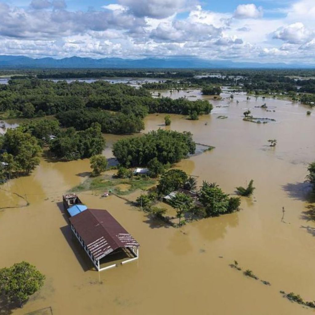
Every monsoon, the Brahmaputra does what it has done for millennia: it rises, spreads across its floodplains and redistributes sediment across Assam. The rainfall may trigger the flood, but the scale of devastation is increasingly engineered by human choices. As this article goes to publication, more than 6.53 lakh people have been affected, 41 lives have been lost, 939 villages remain submerged, and nearly 24,897 hectares of cropland have been damaged. While the Assam government attributed the crisis to a “cloudburst”, the India Meteorological Department (IMD) stated that the rainfall did not meet the meteorological definition of one. The question, then, is not simply why did it rain? It is why does heavy rain repeatedly become a humanitarian catastrophe?
The answer begins with geography—but does not end there. After descending from the Tibetan Plateau through the Himalayas, the Brahmaputra enters Assam near Pasighat, where its gradient suddenly flattens. As the river loses speed, it deposits enormous quantities of sediment—an estimated 400 million tonnes every year, among the highest sediment loads of any river in the world. Over time, this raises the riverbed, making it easier for water to spill into surrounding floodplains. This is a natural process. What is not natural is how we’ve responded to it. Since the 1950s, flood management has relied heavily on embankments that were designed as temporary interventions but gradually became permanent infrastructure. As settlements expanded behind them, wetlands that once absorbed floodwater were filled, forests that slowed runoff declined, natural drainage channels were obstructed, and ageing embankments received reactive rather than preventive maintenance. The result is a river system with fewer places to safely spread and more people and infrastructure directly in its path.
In other words, Assam’s floods are no longer just hydrological events—they are socio-ecological crises. Climate change is intensifying rainfall, but it is interacting with decades of ecological degradation, engineering decisions and unplanned development that have steadily reduced the landscape’s ability to absorb water. The Brahmaputra has not suddenly become more dangerous. We have made ourselves more vulnerable to a river that has never stood still.
However, it is tempting to view Assam’s recurring floods as a consequence of climate change alone. The reality is more nuanced. The Brahmaputra has always been a river of floods, shaped by its vast catchment, braided channels, shifting sandbars and heavy sediment loads. What climate change is altering is not the river’s fundamental nature, but the conditions under which it behaves. A warmer atmosphere can hold around 7% more moisture for every 1°C rise in temperature, increasing the likelihood of intense cloudbursts and erratic monsoon rainfall across the Brahmaputra basin. Yet the severity of flooding is determined just as much by human decisions—shrinking wetlands, expanding settlements on floodplains, ageing embankments, inadequate drainage and persistent riverbank erosion. Climate change, therefore, is best understood not as the sole cause of Assam’s floods, but as a risk multiplier, amplifying an already dynamic river system while exposing vulnerabilities that have been decades in the making.
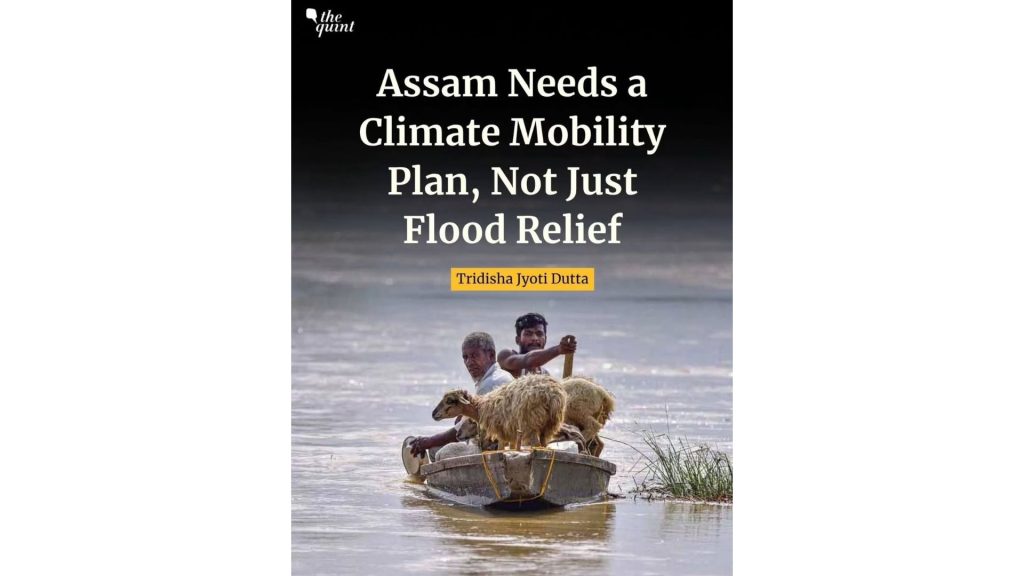
Natural hazards become disasters when development fails to accommodate the landscape it occupies. Wetlands that once absorbed excess water have shrunk, drainage channels have been narrowed, and roads and embankments can interrupt the natural flow of floodwaters. In cities like Guwahati, intense rainfall increasingly overwhelms stormwater systems, while across rural Assam, ageing embankments and inadequate drainage leave settlements vulnerable to prolonged inundation. The consequences ripple beyond submerged homes—markets close, schools suspend classes, crops rot, livestock perish and entire local economies grind to a halt.
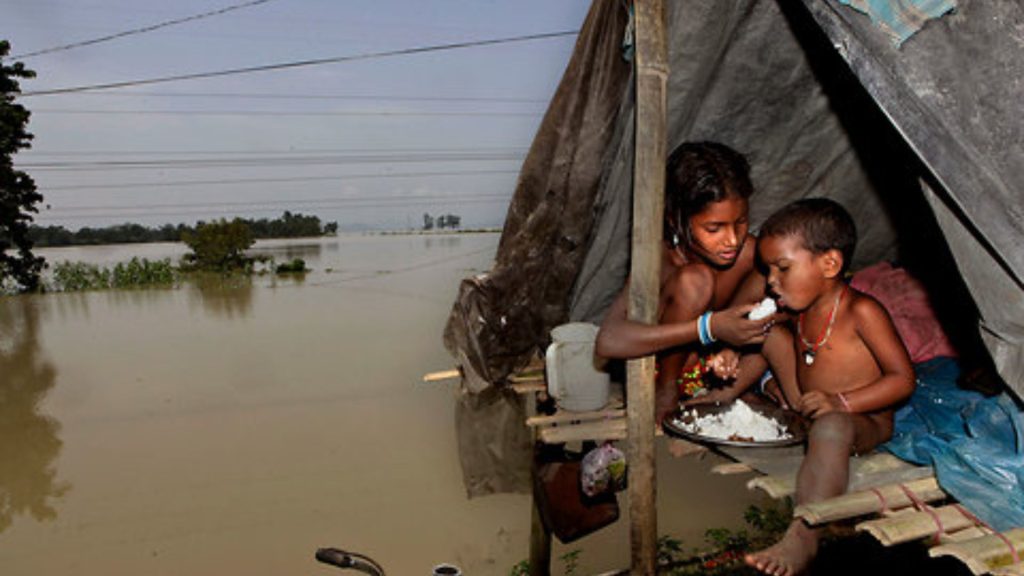
Yet the burden of recovery is rarely equal. A flood may recede in a matter of days, but rebuilding a house, reclaiming farmland or replacing livestock can take years. For erosion-affected families, there may be nothing left to return to; the river often claims not just homes but the land beneath them. The Brahmaputra has always brought water. Whether that water sustains life or deepens vulnerability depends largely on how societies plan, build and adapt around one of the world’s most dynamic river systems.
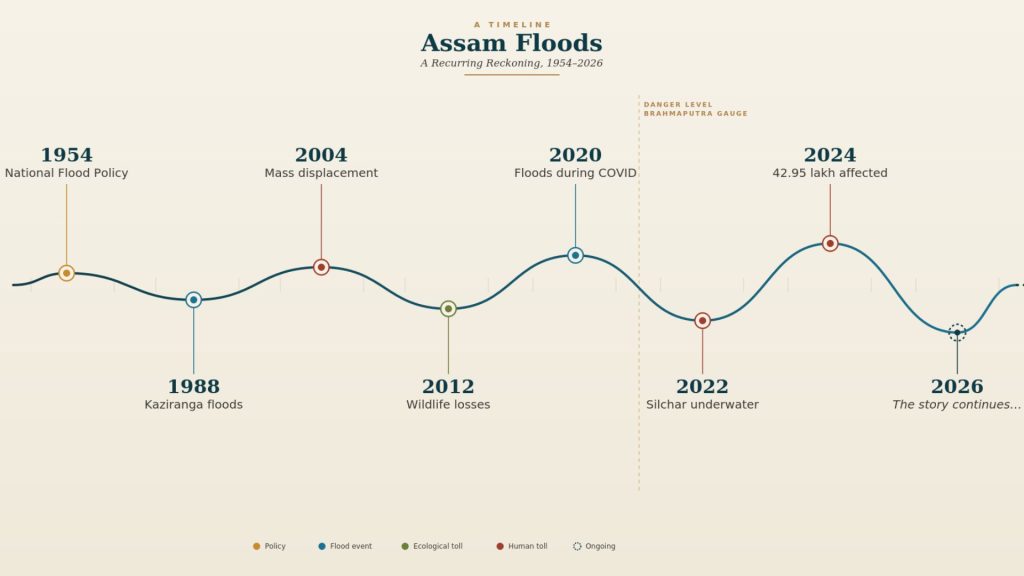
It remembers 1954, when devastating floods prompted India’s first national flood-control policy and embankments became the state’s primary defence. It remembers 1988, when Kaziranga’s wildlife became part of the flood story. It remembers 2004 and 2012, when millions were displaced. It remembers 2020, when floods arrived in the middle of a pandemic. It remembers 2022, when Silchar disappeared beneath water after multiple waves of floods and landslides. It remembered 2024, when more than 42 lakh people were affected. And in 2026, it is writing another chapter—not identical to those before it, but shaped by the same river, new rainfall patterns and changing landscapes.
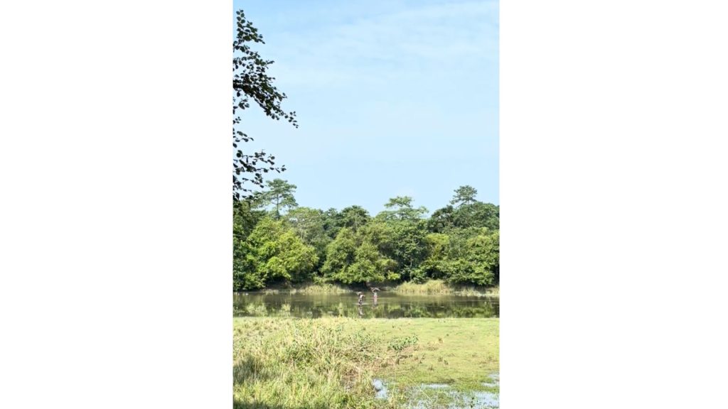
If floods reveal the river’s seasonal power, erosion reveals its permanence. While floodwaters recede, the Brahmaputra rarely returns the land it claims. Since 1954, Assam has lost nearly 4.27 lakh hectares to riverbank erosion—an area larger than the state of Goa. For many families, the greatest loss is not a flooded home but a village that simply disappears from the map. As riverbanks retreat, so do schools, roads, health centres and even legal identities. Families often dismantle their homes plank by plank, relocating repeatedly, while land titles, welfare records and rehabilitation struggle to keep pace with a landscape that refuses to stay still. Nowhere is this more evident than on Assam’s chars and chaporis, where fertile soils sustain generations of livelihoods even as the river continually redraws the ground beneath them.
Majuli offers a closer view of how seasonal flooding, erosion and cultural life coexist on a river island continually shaped by the Brahmaputra.
Read more: Majuli: Where the River Teaches You How to Live
Along the Brahmaputra, home is often not a fixed place—but something rebuilt, again and again.
A flood does not become a disaster the moment water enters a village—it becomes one when the systems people depend on begin to fail. A washed-out bridge means an ambulance never arrives. A school converted into a relief camp interrupts education long after the rain has stopped. Contaminated tube wells turn flooding into outbreaks of diarrhoeal disease and malnutrition, while damaged roads sever access to markets, medicines and livelihoods. These failures fall hardest on those already most vulnerable: children who lose months of schooling, pregnant women struggling to access healthcare, older persons dependent on regular medication, and people with disabilities navigating inaccessible shelters. Yet Assam’s story is also one of remarkable adaptation. Long before satellite imagery, AI forecasting and mobile alerts, riverine communities built raised chang ghars, moved livestock before roads disappeared, stored documents in waterproof packets and learnt to read the Brahmaputra’s changing currents. Among the Mising communities of Majuli, architecture, agriculture and everyday routines offer a more detailed example of living with the river’s changing conditions.
Read more: The Mising Tribe of Majuli, Assam: River, Resilience & Ritual
The challenge today is not simply predicting floods—it is ensuring that modern technology, resilient infrastructure and public policy work alongside this local knowledge so that a natural flood no longer spirals into a preventable humanitarian crisis.

For over seventy years, Assam has tried to stop the Brahmaputra from flooding. After the devastating floods of 1954, embankments became the centrepiece of India’s flood-control strategy. They protected towns and farmland, but they also encouraged development deeper into floodplains. Wetlands that once absorbed excess water were reclaimed, forests that slowed runoff disappeared, and ageing embankments became permanent infrastructure without matching investment in maintenance. The river did not become more dangerous—we engineered greater vulnerability around it.
The future lies not in fighting the river, but in building with it. That means restoring wetlands like Deepor Beel as natural flood buffers, enforcing floodplain zoning, strengthening embankments through routine audits rather than emergency repairs, and designing roads and culverts that allow water to move naturally. Technology must become part of the solution too: satellite imagery, GIS floodplain mapping, AI-powered flood forecasting, automatic weather stations, river gauges and drones can predict where water will spread days in advance. But sophisticated models only matter if they reach the last mile through local-language alerts, village-level forecasts and clear evacuation triggers. Combined with flood-resilient housing, climate-smart agriculture, faster insurance, planned relocation from erosion hotspots and basin-wide coordination across the Brahmaputra, these measures shift the focus from controlling floods to reducing risk. Floods are inevitable. Humanitarian disasters are not. The Brahmaputra will continue to rise every monsoon; whether it becomes a catastrophe depends on the choices we make before the water arrives.
Support relief efforts
Assam needs our attention. Below are verified organisations supporting relief and recovery through food, clean water, hygiene kits, baby food, sanitary supplies, medicines and long-term rehabilitation. If you’re able to, consider contributing.
Assam floods almost every monsoon because it lies within the floodplains of the Brahmaputra and Barak river systems. Heavy rainfall, snowmelt from the Himalayas, sediment deposition, riverbank erosion and the state’s unique geography all contribute to seasonal flooding. Climate change is intensifying rainfall variability, but it is one of several factors shaping flood risk.
No. Flooding has always been part of Assam’s natural landscape. Climate change acts as a risk multiplier, increasing the likelihood of extreme rainfall and making flood events more unpredictable. However, floodplain development, shrinking wetlands, riverbank erosion, embankment management and drainage infrastructure also play major roles.
The Brahmaputra is one of the world’s largest braided rivers. It carries enormous volumes of water and sediment from the Himalayas and receives rainfall from multiple states and neighbouring Bhutan. These natural processes cause the river to frequently change course, overflow its banks and reshape surrounding landscapes.
Flooding is usually temporary, with water receding after days or weeks. Riverbank erosion is permanent. Entire villages, farms and roads can disappear as the river gradually eats away at its banks, forcing repeated displacement of communities.
Floodplains and river islands (chars and chaporis) have fertile soils that support agriculture, fisheries and livestock. For many families, moving is not simply a personal choice—it is constrained by livelihoods, land ownership, community ties and limited access to alternative land.
Seasonal floods are essential for Kaziranga’s ecology, replenishing grasslands and wetlands. During high floods, however, animals such as rhinos, elephants and deer move towards the Karbi Anglong hills in search of higher ground, increasing the risk of road accidents and human-wildlife interactions.
Embankments remain an important part of flood management because they protect towns, agricultural land and transport networks. However, experts increasingly argue that embankments alone cannot eliminate flood risk. Modern flood management combines structural protection with wetland restoration, better forecasting, floodplain zoning and resilient infrastructure.
Living with water means recognising that floods cannot be completely prevented. Instead of trying to stop every flood, communities and governments focus on reducing risk through early warnings, resilient housing, protected wetlands, smarter land-use planning, flood-resilient agriculture and faster recovery systems.
Travel depends on the location, timing and flood conditions. While many parts of Assam remain accessible during the monsoon, flood-prone districts may experience road closures, ferry disruptions and temporary restrictions. Travellers should monitor official weather and flood advisories before planning their journey.
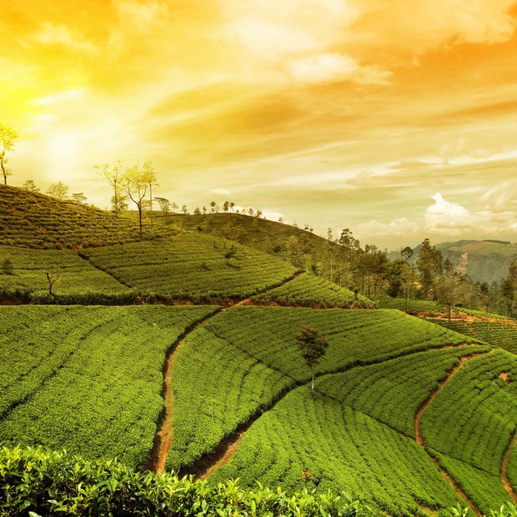
The most reliable period for travel is typically November to March, after the monsoon has receded. During these months, weather conditions are cooler and drier, making it easier to explore destinations such as Kaziranga National Park, Majuli, Guwahati and the tea gardens.

Equal parts policy wonk and wanderlust junkie, Kavya brings together her training in environmental economics and political science with an enduring curiosity about how the world works — and how it could work better. By day, she’s a public health researcher and advocate, working at the intersection of people, systems, and the planet.
Off the clock? She’s a storyteller, active rester, and cat mama.