The Siang is more than megawatts

There are rivers that appear on maps as blue lines, are measured in cubic metres per second, and are valued for the electricity they can generate. These same rivers exist in the memory of a people: in the names of their villages, the boundaries of their ancestral lands, the stories told by their grandparents, and the food grown along their banks. For example, The Siang, in Arunachal Pradesh
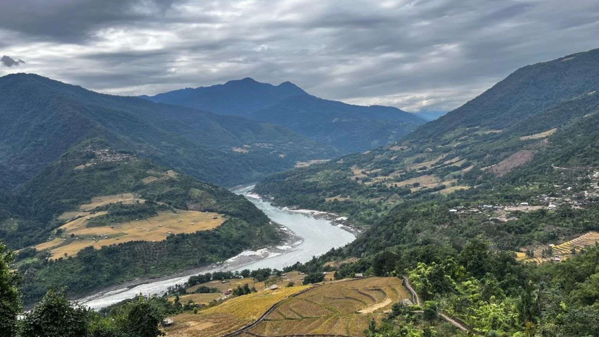
The Siang River flowing through the Eastern Himalayas in Arunachal Pradesh
The Siang cuts through the Eastern Himalayas, sustaining the communities and landscapes along its banks. Courtesy: DTE

Flowing south from the Tibetan plateau, where it is known as the Yarlung Tsangpo, the river cuts through the eastern Himalayas before entering Arunachal Pradesh as the Siang. Further downstream, it joins the Lohit and Dibang to form the Brahmaputra in Assam, eventually continuing its journey into Bangladesh. But its geography tells only part of the story.

For the Adi communities of the Siang Valley, the river is deeply woven into the organisation of everyday life: its waters sustain fishing and agriculture, its seasonal fluctuations have traditionally helped communities anticipate changes in weather and plan their farming activities, and its banks and surrounding forests support livelihoods built over generations. It also occupies a place in Adi cosmology, oral traditions, folklore and collective memory. Revered as Ane Siang (Mother Siang), it is regarded as sacred and is associated with protection, healing and the continuity of community life. The river, in other words, is not simply something the Adi live beside; it is part of the landscape through which they understand their history, sustain their livelihoods and reproduce their cultural identity. To alter its course, therefore, is to potentially alter an entire way of life
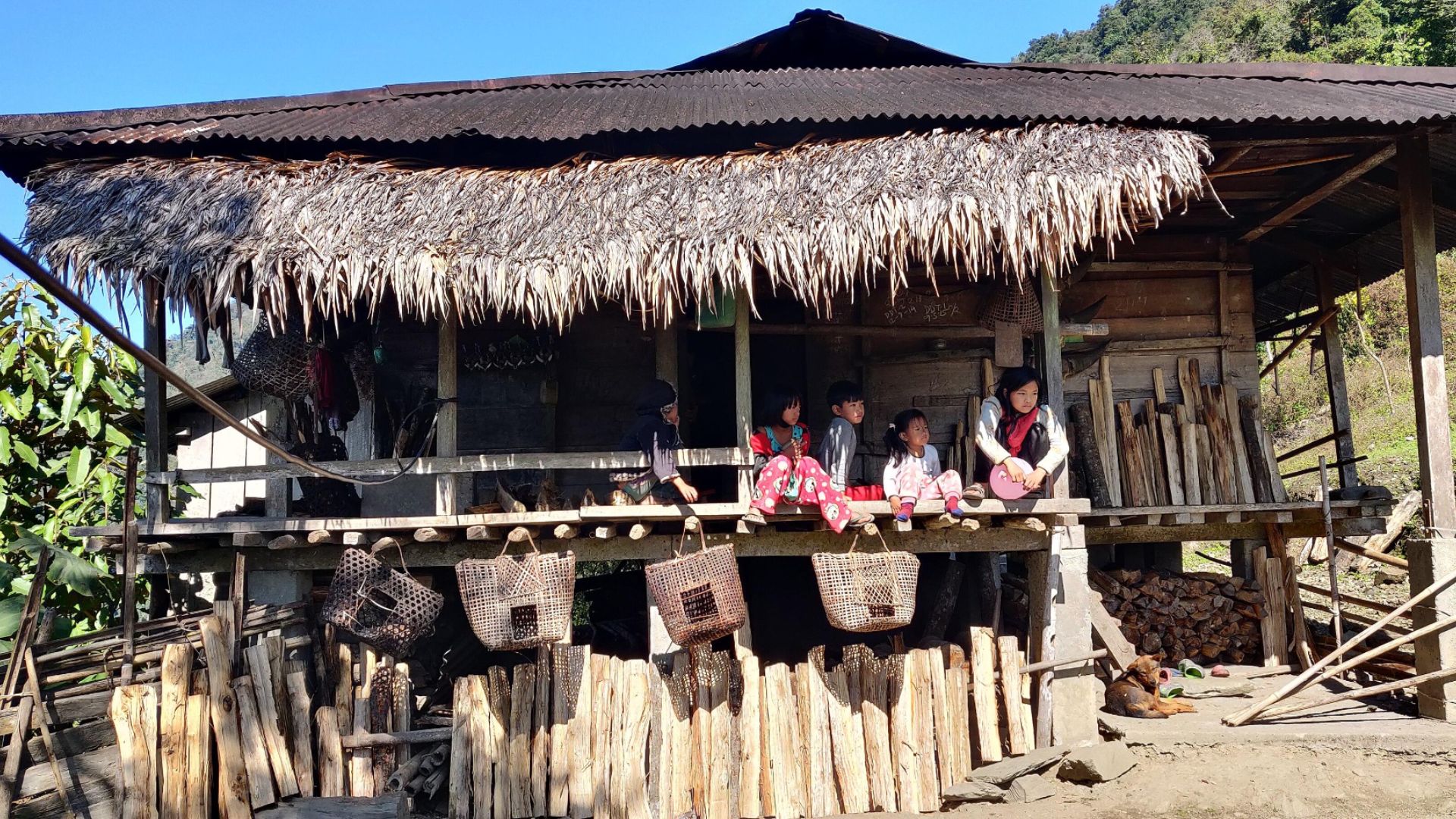
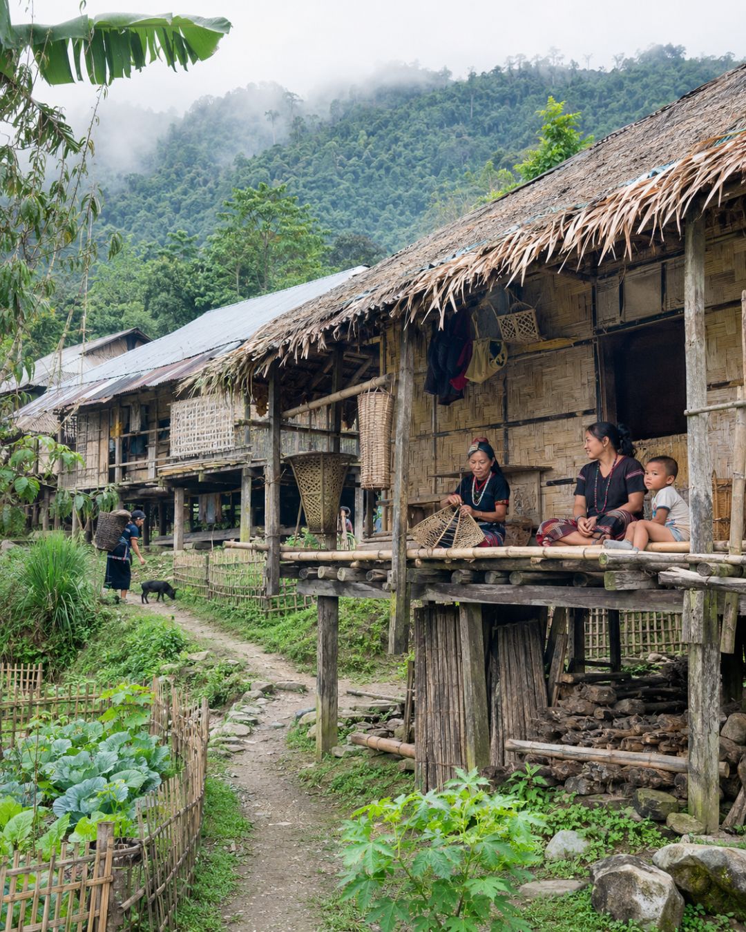
A traditional Adi home in Gete village, Upper Siang
A traditional Adi home in Gete village, Upper Siang. Homes, land and community life are closely connected to the surrounding landscape. Courtesy: Wikimedia Commons

Today, this relationship is at the centre of one of Northeast India's most consequential environmental and indigenous rights conflicts. The proposed Siang Upper Multipurpose Project (SUMP), an 11,200 MW mega-dam near Geku in Upper Siang district, is being presented by the Indian government as an infrastructure project of national and strategic importance. It is expected to generate substantial hydropower and provide a degree of water security against China's proposed hydropower development upstream on the Yarlung Tsangpo.

But for communities living along the Siang, the question is not simply how much electricity a dam can produce. It is what must disappear to make that electricity possible. The costs. And, perhaps more importantly, who gets to decide?
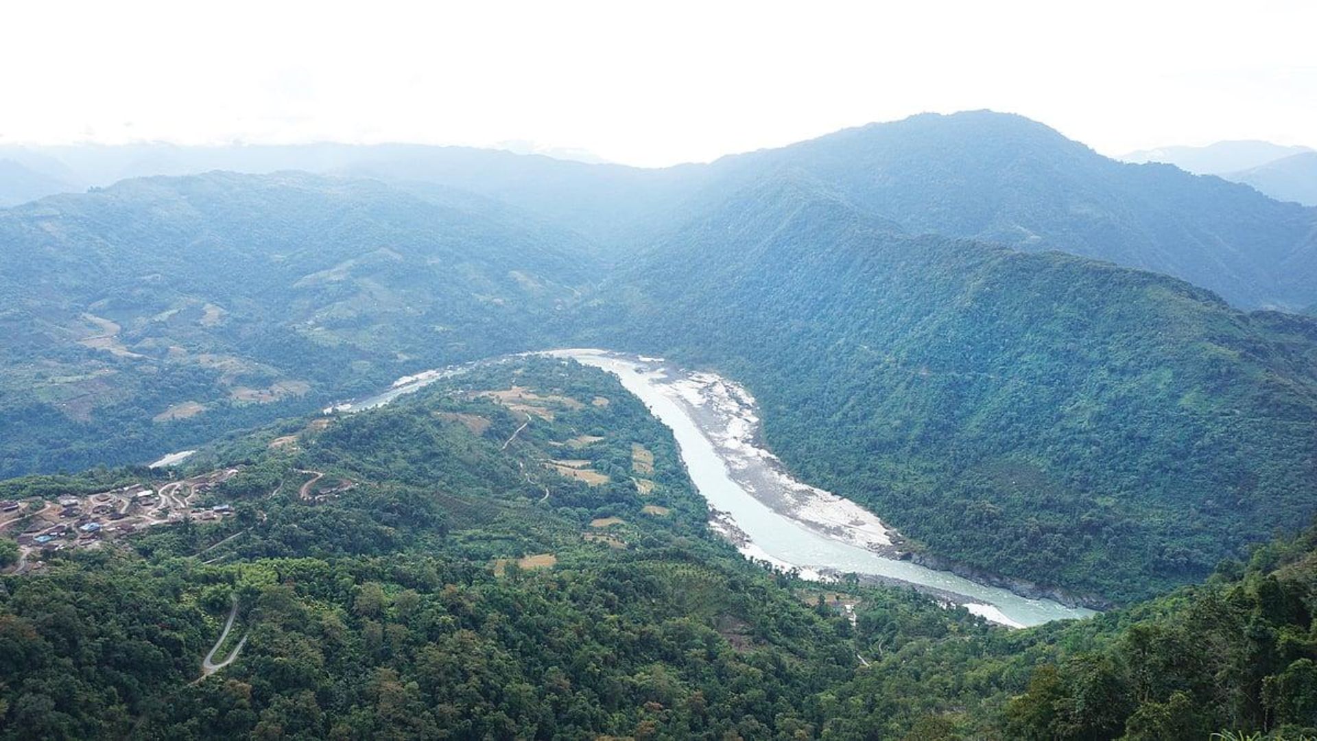
Aerial view of the Siang River winding through forested hills in Arunachal Pradesh
The Siang winds through forested hills and cultivated land in Arunachal Pradesh. The proposed hydropower project would transform a landscape that already sustains generations of communities. Courtesy: DTE

A river caught between two countries

The Siang's present predicament cannot be understood without looking north, across the international border. The Yarlung Tsangpo originates in Tibet and travels eastwards before making a dramatic turn around the Himalayas and entering Arunachal Pradesh as the Siang. China has announced plans for a massive hydropower project in the lower reaches of the Yarlung Tsangpo, near the Great Bend, with a proposed capacity of approximately 60,000 MW. For India, the prospect of a major Chinese dam upstream raises questions about water security, downstream flows and the possibility of sudden water releases. The Siang Upper Multipurpose Project has consequently acquired a strategic dimension beyond its electricity-generating potential.

The Indian government's argument is that a large storage reservoir could help regulate river flows, strengthen water security and mitigate potential flood risks, particularly in light of China's proposed hydropower development upstream on the Yarlung Tsangpo. The project has consequently acquired a strategic significance that extends well beyond electricity generation.

Yet, in responding to one geopolitical uncertainty, India risks creating another set of uncertainties for the people and ecosystems of the Siang Valley. The proposed dam would introduce an enormous infrastructure intervention into a seismically active, ecologically fragile Himalayan landscape, where earthquakes, landslides, extreme rainfall and climate change already place considerable stress on natural systems. Its potential consequences for river flows, sediment movement, forests, biodiversity and downstream communities demand far more than assurances of engineering feasibility. Equally concerning is the growing atmosphere of mistrust surrounding the project, with residents opposing the surveys facing arrests and restrictions on dissent. A development project of this magnitude cannot be advanced in isolation from the people whose lives it may fundamentally alter.

Why does the ambit of ‘security’ exlude a farmer whose fields may disappear, a community whose ancestral territory may be submerged, and a river ecosystem whose resilience sustains millions downstream (and its intersectional consequences for all of Arunchal, and India).

The people of the Siang should not have to surrender their homes, livelihoods and ecological inheritance to bear the costs of a geopolitical contest over which they have little say.

What does it mean to lose a village?

The figures associated with the project are staggering. The Siang Indigenous Farmers' Forum (SIFF) has warned that approximately 27 villages could be submerged, with several more affected by the project. The scale of potential displacement has become one of the principal reasons for resistance among communities in the valley. Yet the language of displacement can be deceptively simple. In official documents, a village may be represented through a list of households, hectares of land, structures, roads and other assets. Relocation can then appear to be a logistical exercise: identify the affected population, calculate compensation, allocate alternative land and construct housing elsewhere.
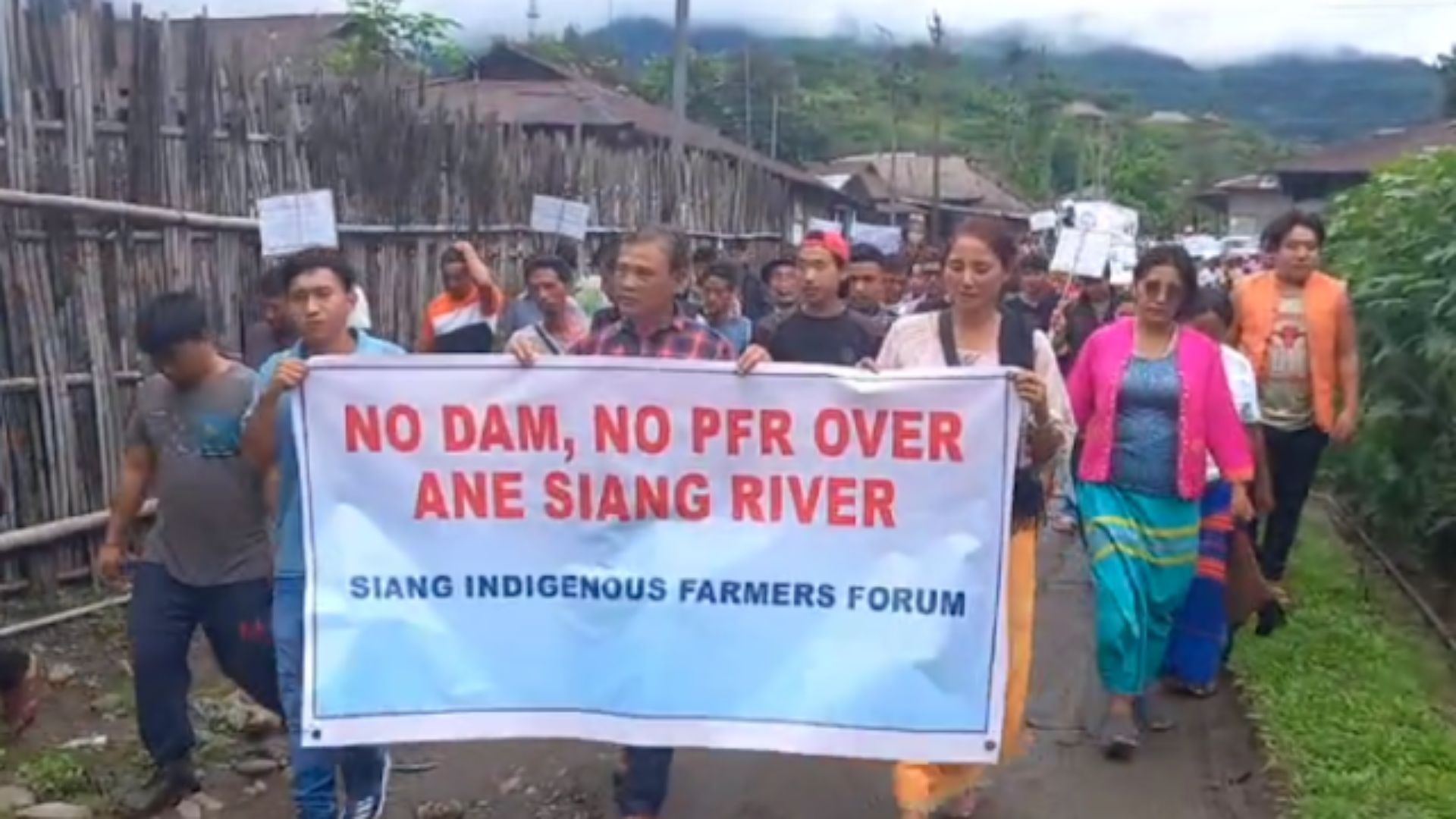
People protesting against the proposed Siang hydropower project in Arunachal Pradesh
Courtesy: Counterview

But in Arunachal Pradesh, as across much of Northeast India, the relationship between people and their landscapes runs far deeper than the boundaries of a property. Rivers are woven into everyday life, forests are extensions of the household economy, and land carries the memory of generations who have cultivated it, lived on it and passed it down. Food, too, is inseparable from this relationship: from the fields that sustain families to the rivers and forests that provide nourishment through changing seasons. To lose a landscape here is not simply to lose a place to live; it is to lose a way of knowing the world, of feeding a family, of belonging to a community and of recognising oneself in the land.

This understanding of displacement assumes that a home is primarily a physical structure. But that has never been the case for Arunachal, and all of North East.

Consider the question of customary land ownership. In the Siang Valley, village territories are not empty spaces waiting to be allocated. They are embedded in established community boundaries, clan histories and relationships between neighbouring settlements. Moving one community into another territory is therefore not necessarily a straightforward administrative exercise. It raises questions about who owns the land, who has the authority to offer it, and what happens to the people who already depend on it.

A displaced household may receive a new house, but where does it find the land to cultivate? Where does it access the forest? How does it reconstruct relationships with neighbours, relatives and other communities? What happens to the village institutions through which everyday disputes are settled and collective decisions are made? These are not sentimental concerns. They are questions about the material organisation of life.

In a 2025 report for Down To Earth, Anupam Chakravartty and Jyotirmoy Saharia documented the anxieties of farmers in Parong and other villages. Farmer Anthony Pabin expressed the fear that his children could grow up as refugees, separated from their ancestral land. The word refugee is particularly revealing here. It suggests that displacement is not only about losing a place to live. It is about losing the conditions that allow a community to remain socially and culturally rooted.

The economy that already exists along the Siang

One of the more persistent assumptions underlying mega-infrastructure projects is that the land affected by them represents an economic opportunity waiting to be unlocked. This is especially problematic in regions where livelihoods are distributed across farms, forests, rivers and informal local markets, rather than concentrated in formal industries.

The Siang Valley is not an economically vacant landscape.

Adi communities have developed agricultural systems adapted to the terrain, cultivating paddy, maintaining orchards, practising jhum cultivation and harvesting forest produce. The hillsides are interspersed with cultivated plots, while roadside markets bring together produce from settlements located further uphill and along the river. Women can often be seen selling fruits, roots, vegetables, seeds, meats, crafts and medicinal plants at makeshift roadside stalls. These exchanges are not simply small commercial transactions. They are part of a local economy sustained by relationships between producers, consumers, landscapes and seasons.

The Centre of Excellence for Himalayan Studies at Shiv Nadar University, in its March 2026 study of the Siang project, describes the valley as a densely populated and intensively cultivated landscape, with some of its oldest Adi settlements. It also documents the importance of paddy fields, jhum plots, orange orchards and pineapple cultivation to local livelihoods. For families growing oranges or cultivating terraced fields, the value of land is not exhausted by its market price. It includes the labour invested over decades, the knowledge passed between generations and the ability to sustain a household without depending entirely on external markets.

There is also an important question of what happens after compensation runs out?

A one-time financial settlement may compensate for the immediate loss of a house or a field. It cannot necessarily recreate a productive agricultural landscape, replace access to forest resources or guarantee a sustainable source of income for the next generation. The problem is particularly acute when the proposed rehabilitation site is itself contested or ecologically unsuitable.

As one question raised by an interviewee in the Shiv Nadar University study makes clear: if traditional community territories are already demarcated, whose land will be given to those being displaced? This is where the conventional language of rehabilitation begins to fall short. Relocation may move a population, but it does not automatically recreate the conditions under which that population has historically lived.

The flood question: Can a dam really make the Brahmaputra safer?

Flood management is among the principal justifications offered in support of the Siang project. The government has argued that a large reservoir could regulate water flows and provide protection against potentially sudden releases from China's upstream infrastructure. At first glance, the argument appears intuitive: if a dam can store water, it can prevent that water from reaching downstream communities all at once.

But Himalayan rivers are not simple hydraulic systems. Their behaviour is shaped by monsoon rainfall, steep mountain gradients, landslides, glacial processes, sediment movement and the changing conditions of their catchments.
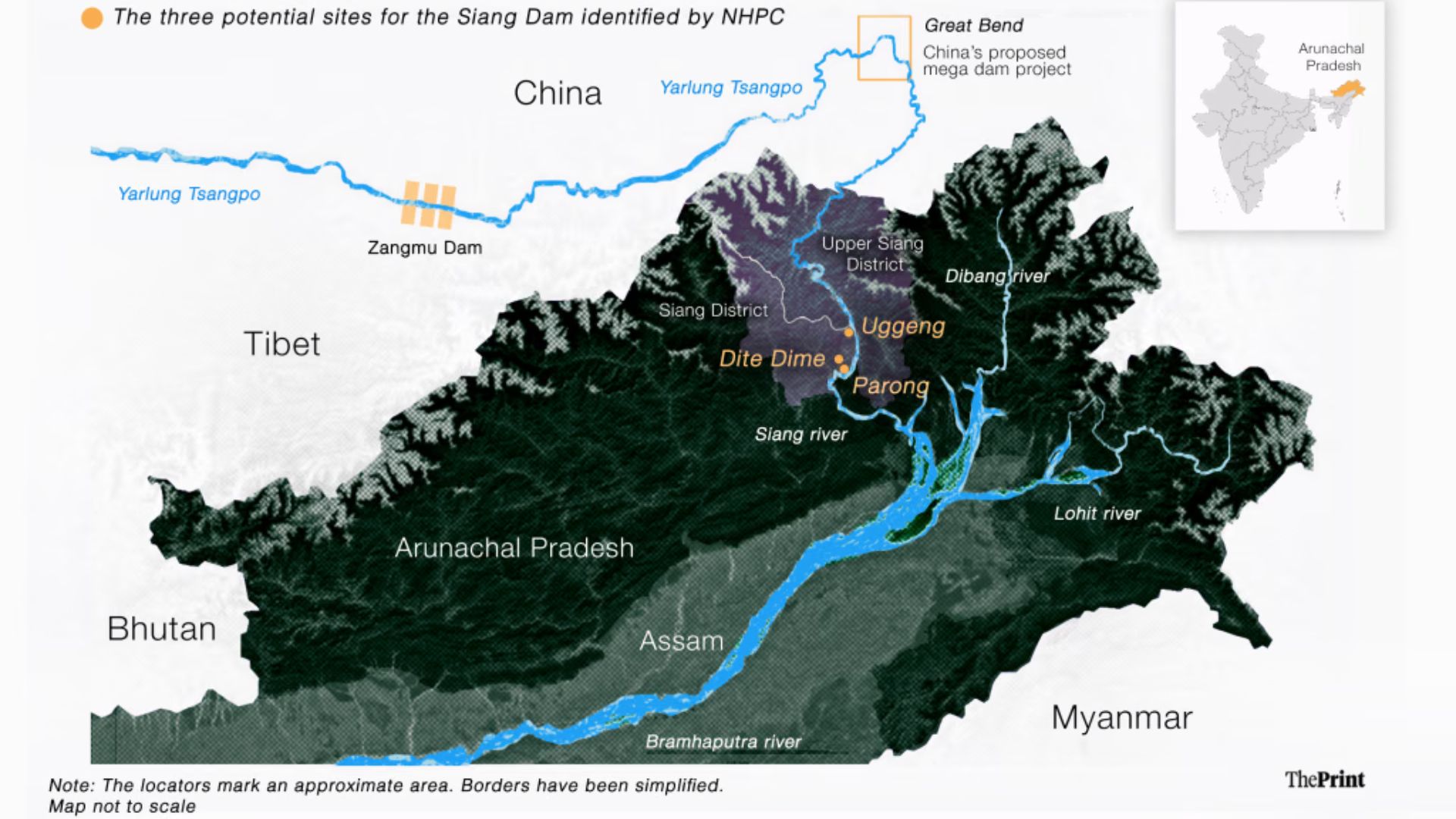
Map of the Siang River and surrounding region

The Siang is particularly important in this regard. Scientific research published in Earth Surface Processes and Landforms in 2020 examined the river's geological record and identified evidence of at least eight large flood events over a period spanning approximately 7,000 to 1,000 years before present. These floods were associated with complex interactions between rainfall, mountain erosion, sediment movement and glacial or landslide lake outburst events.

The concern, therefore, is not simply whether the river floods. It is how a large storage structure would behave within an already dynamic Himalayan landscape. A reservoir can moderate certain flood peaks if sufficient storage capacity is available and releases are managed appropriately. This is a genuine potential benefit. But it is not a guarantee against flooding.

The effectiveness of flood moderation depends on several conditions: how much storage remains available when heavy rainfall occurs, how accurately inflows can be forecast, what operating rules govern the reservoir, and how quickly water must be released when storage limits are approached.

There are other risks that deserve equal attention.

The Siang carries substantial sediment from an actively evolving Himalayan catchment. A large reservoir can trap sediment, gradually reducing its effective storage capacity. It can also alter the movement of sediment downstream, affecting river channels, banks, wetlands and floodplain agriculture.

Changes in the timing and volume of releases can produce sudden fluctuations in downstream river levels. Poorly coordinated reservoir operations, extreme rainfall, landslide-induced blockages or structural failure can introduce additional hazards.

It would be scientifically irresponsible to claim that the proposed dam will inevitably increase floods. Equally, it would be irresponsible to assume that it will necessarily prevent them.

The appropriate question is whether the project can demonstrate, through independent and publicly accessible hydrological modelling, dam-break assessments, sediment studies and cumulative basin-level impact assessments, that its flood-management benefits outweigh its risks. This is especially important for Assam, where communities downstream already live with the annual uncertainty of Brahmaputra floods.

A river does not stop being part of a larger ecosystem simply because an infrastructure project has been built across it.

A fragile landscape beneath a massive structure

There is another dimension to the debate: the geological and ecological character of the eastern Himalayas. Arunachal Pradesh is part of a highly active tectonic landscape. Its steep slopes, fragile geology and intense monsoon conditions make the region particularly sensitive to landslides, erosion and seismic events. Building a large reservoir in such a landscape demands exceptionally rigorous geological and seismic assessment.

One concern associated with large reservoirs is reservoir-induced seismicity, in which changes in water pressure and stress within underlying rocks can potentially influence existing geological faults. This does not mean that every large dam in a seismic region will trigger an earthquake. It does mean that the relationship between reservoir loading, local geology and seismic activity must be carefully assessed.

The ecological consequences are similarly complex. Large reservoirs can submerge forests and agricultural land, fragment habitats, change aquatic ecosystems and obstruct fish movement. Altered sediment flows can affect downstream habitats and the productivity of riverine landscapes. These effects are not confined to the area immediately beneath the reservoir. Rivers connect ecological systems across considerable distances, carrying sediment, nutrients and organic material downstream.

In the eastern Himalayas, where mountain slopes, forests and river systems are closely interconnected, the ecological footprint of a mega-dam cannot be assessed by looking only at the construction site. There is also the question of cumulative impact. The Siang is part of a wider basin in which several hydropower projects have been proposed. Assessing one dam in isolation may not adequately capture the combined consequences of multiple structures on river flows, sediment movement and aquatic ecosystems.

The Central Water Commission's cumulative impact assessment of the Siang basin has itself highlighted the possibility of extensive reservoir development along the river. Its assessment of earlier project configurations envisaged long stretches of the river being converted into a near-continuous reservoir system.

The issue is not whether hydropower is inherently undesirable. It is whether the ecological carrying capacity of a landscape is being taken seriously before its rivers, and lives nourished and affected by it are disturbed.

Ane Siang: When a river is also an ancestor

Perhaps the most difficult dimension of the Siang conflict to capture in a project report is its cultural significance. For the Adi, the river is known as Ane Siang, or Mother Siang, and is deeply woven into their relationship with the natural world. Land, forests and rivers are not merely sources of livelihood; they hold ancestral memory, customary knowledge, oral histories and the social relationships through which communities understand their place in the world. Altering this landscape, therefore, is also to alter the cultural and social life built around it.

This is why Adi resistance cannot simply be framed as a conflict between tradition and modernity. Communities are not necessarily rejecting roads, electricity, healthcare or economic opportunity. They are questioning a model of development in which decisions about their territories are made elsewhere, while the consequences are borne locally.

Their resistance also draws upon longstanding institutions of collective governance. In August 2025, the Adi community convened a Bogung Bokang Kebang at Geku, bringing together elders, village representatives, student organisations and community leaders to deliberate on the proposed project. A kebang is a traditional deliberative council through which communities discuss matters of collective importance. As Tadu Rimi documents in the Centre of Excellence for Himalayan Studies' March 2026 study, this mobilisation draws upon customary institutions, kinship networks and indigenous systems of decision-making. The community is not simply opposing a dam; it is asserting its right to have a say in the future of its ancestral territory. Consent, in this context, is not a procedural formality. It is a question of who has the authority to decide what happens to a people's home.


Development for whom?

The Siang conflict exposes a larger contradiction in how development is imagined in India's frontier regions. Rivers become hydropower resources, forests become land-use categories and inhabitants become project-affected families. While the benefits are framed in terms of national electricity generation, revenue, employment and energy security, the costs are concentrated among the communities and ecosystems that must bear them. For the Adi, this could mean losing ancestral villages, agricultural land and cultural autonomy; for downstream populations, uncertainties around river flows, sediment and flood safety; and for the wider Himalayas, further ecological disruption. This is not an argument against development or a suggestion that Arunachal Pradesh should be denied the electricity, connectivity, healthcare and economic opportunities available elsewhere in the country. Rather, it asks who gets to define progress, and at whose expense. Development must account not only for the megawatts generated but also for the security of livelihoods, ecological resilience and the right of communities to shape their own futures. That requires transparent environmental assessments, meaningful consultation, recognition of customary land rights and serious consideration of less disruptive alternatives.

Above all, it requires recognising that when communities resist a project, they are not necessarily resisting progress; they may simply have a different, deeply informed understanding of what is worth preserving.

The future of the Siang is not a local question alone

The Siang is not merely an Arunachali river; it is part of the larger Brahmaputra basin, connecting Tibet, Arunachal Pradesh, Assam and Bangladesh through an interconnected hydrological system. Changes to its upstream flows, sediment and ecology inevitably have consequences beyond political and administrative boundaries, making basin-wide thinking and transboundary cooperation essential. Yet, as opposition to SUMP intensifies, the debate has increasingly moved beyond environmental and engineering concerns to questions of consent, governance and the right to dissent. Protests, arrests and the deployment of security personnel have deepened mistrust between local communities and the state. For anyone travelling through the Siang Valley, its rivers, forests, orange orchards, terraced fields and village markets may appear as an extraordinary Himalayan landscape. But these are not simply scenic backdrops; they are inhabited, cultivated and remembered landscapes, sustaining entire social and economic worlds.

Perhaps this is what the Siang conflict ultimately asks us to recognise: a village cannot be relocated like an apartment, a river cannot be valued only in megawatts, and a community cannot be compensated for a future it was never given the opportunity to choose.

Sources

Research papers, reports and journalism informing this article on the Siang River, hydropower development, environmental risks and indigenous communities.

  1. 01

    Capturing Siang: As India pushes for a mega-dam on the Siang river to counter China’s upstream projects, the Adi tribal community of Arunachal Pradesh fears losing ancestral land

    Chakravartty, A. and Saharia, J. (2025)

    Down To Earth, 17 January.

    Read article
  2. 02

    Local Response to National Projects: The Siang Hydropower Project in Arunachal Pradesh

    Rimi, T. (2026)

    Centre of Excellence for Himalayan Studies, Shiv Nadar University, Issue 30, March.

    View research
  3. 03

    Threats, detentions, militarisation: How Arunachal government is choking anti-dam protests

    Zaman, R. (2026)

    Scroll.in, 24 October.

    Read article
  4. 04

    Assembly ban imposed in Upper Siang, protesters detained under UAPA

    Sirur, S. (2026)

    Mongabay-India, 14 October.

    Read article
  5. 05

    Once against dams, now backing one: China’s shadow over Arunachal politics

    Mazoomdaar, J. (2026)

    The Indian Express, 13 October.

    Read article
  6. 06

    Chronology and sediment provenance of extreme floods of Siang River (Tsangpo-Brahmaputra River valley), northeast Himalaya

    Panda, S., Kumar, A., Das, S., Devrani, R., Rai, S., Prakash, K. and Srivastava, P. (2020)

    Earth Surface Processes and Landforms.

    View research paper
  7. 07

    Cumulative Impact and Carrying Capacity Study of Siang Sub-basin Including Downstream Impacts, Volume I

    R.S. Envirolink Technologies Pvt. Ltd. (2013)

    Prepared for the Central Water Commission, Government of India.

    View report (PDF)
  8. 08

    Stress pattern analysis and its tectonic implications in the Eastern Himalayan Syntaxis: A special emphasis to the Siang Valley, Arunachal Pradesh, Northeast India

    Pal, A., Yadav, D.K., Baruah, D., Gupta, A.K., Nainwal, H.C. and Sahu, P. (2025)

    Himalayan Geology, 46(2), pp. 184–195.

    View research paper (PDF)
  9. 09

    Landslides along frontal part of Eastern Himalaya in East Siang and Lower Dibang districts, Arunachal Pradesh, India

    Luirei, K. and Bhakuni, S.S. (2008)

    Journal of the Geological Society of India, 71(3), pp. 321–330.

    View research paper
  10. 10

    General Bogum Bokang Kebang rejects SUMP, mega projects on Siang

    Staff Reporter (2025)

    The Arunachal Times, 22 August.

    Read article
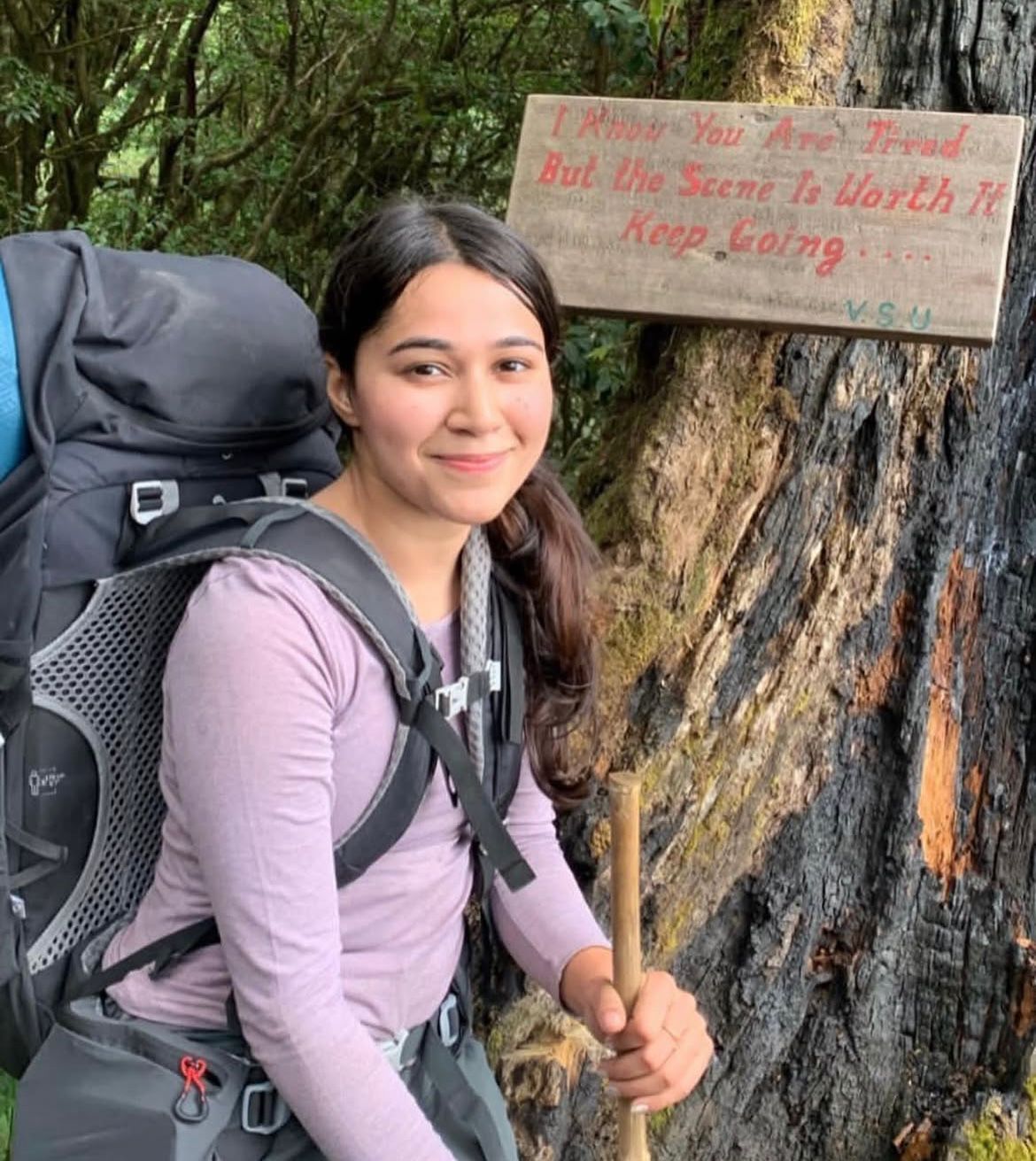
Kavya on a trail with her backpack

About the author

Kavya

Equal parts policy wonk and wanderlust junkie, Kavya brings together her training in environmental economics and political science with an enduring curiosity about how the world works — and how it could work better. By day, she’s a public health researcher and advocate, working at the intersection of people, systems, and the planet.

Off the clock? She’s a storyteller, active rester, and cat mama.